PORTS® launches in Jacksonville, FL
posted by AJOT | Jul 24 2014 at 04:33 PM | Ports & Terminals
Top NOAA officials from Washington, D.C. joined local maritime leaders recently at a ceremony dedicating a new sensor system designed to save money, improve safety and enhance research regarding conditions in the St. Johns River.
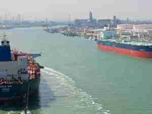
The $2.8 million Physical Oceanographic Real-Time System (PORTS®) offers data from 18 stations comprised of 46 sensors located along 67 miles of the St. Johns River in Northeast Florida.
As the second largest PORTS® installation in the nation, the system provides instant tidal and weather information to commercial, military and recreational users, and compiles invaluable research data for use by academic institutions, environmental scientists and agencies such as the National Weather Service.
"Our nation's ports are critical cogs in our country's economic engine," said Kathryn D. Sullivan, Ph.D., under secretary of commerce for oceans and atmosphere and NOAA administrator. "NOAA's PORTS system gives shipping companies, captains, fishermen and others vital environmental intelligence that helps them navigate these waters more safely and efficiently. This is a win-win for the port, our partners, the surrounding communities and every business and industry that depends upon this flow of goods."
Knowledge of the currents, water levels, winds and density of the water can enable shippers to optimize cargo loads so that vessel captains and pilots are using every inch of available channel depth safely, maximizing profits and efficiency.
"The real-time information provided by PORTS is invaluable to balancing JAXPORT's dual priorities of enabling safe and efficient commerce while protecting the natural resources so critical to our quality of life in Northeast Florida," said Brian Taylor, CEO of the Jacksonville Port Authority. "We know this system makes us a more competitive port and will help us fulfill our mission of contributing to the region's overall vibrancy."
The National Oceanic and Atmospheric Administration (NOAA) developed the system. NOAA also collects, quality controls and disseminates the data, which is updated every six minutes. The Jacksonville Marine Transportation Exchange (JMTX) purchased and installed the system through a grant from the Federal Emergency Management Agency (FEMA).