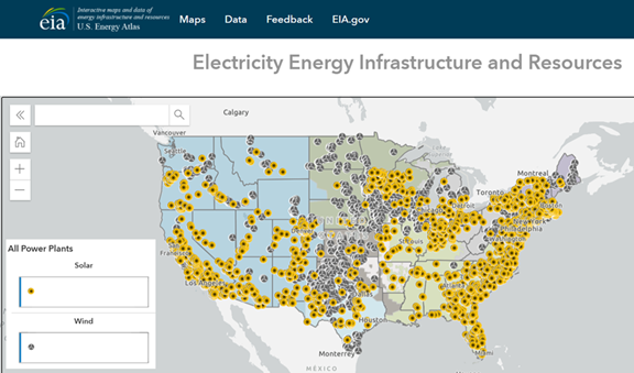
Today, the U.S. Energy Information Administration (EIA) released the U.S. Energy Atlas, a new interface for web map applications and a comprehensive open data catalogue. The U.S. Energy Atlas shows detailed energy infrastructure in redesigned maps with enhanced navigation and data accessibility features. With the U.S. Energy Atlas, users can now combine EIA’s data with information from other sources to customize their own geospatial analysis.
The U.S. Energy Atlas features 84 map layers, 60 of which are based on EIA surveys. EIA data published in the U.S. Energy Atlas include locations of power plants, coal mines, oil and natural gas wells, pipelines, storage facilities, natural gas processing plants, refineries, and other types of energy facilities.
The U.S. Energy Atlas incorporates many new features, most notably access to new web map applications such as new energy infrastructure maps, disruptions maps, and an open data catalogue. Users can download entire datasets or filtered subsets in a variety of data formats, including shapefile, KML file, geodatabase file, and spreadsheet. Previously, EIA provided these datasets only in shapefile format.
The U.S. Energy Atlas provides the public, policymakers, analysts, and other stakeholders with access to useful energy infrastructure information through open source data and interactive web map applications. For example, when natural disasters such as hurricanes, tropical storms, or wildfires form, these customized maps help users see what key energy infrastructure elements could be affected.


