CAL Analytics, in coordination with the Ohio Department of Transportation (ODOT), has launched a low-altitude air traffic management system for drones to support statewide operations. As the number of uncrewed aircraft systems (UAS), or drones, grows, a robust system for managing the low-altitude airspace where these aircraft operate is necessary to ensure safety. While the Federal Aviation Administration (FAA) provides air traffic control for traditional aircraft flying in certain airspaces, low-altitude traffic management for drones is the responsibility of individual operators. Currently, drone pilots are required to keep the aircraft within sight to avoid a collision. A UAS Traffic Management (UTM) system enhances safety by enabling sharing of flight details between UAS operators, providing a digital tool for flight planning, and allowing operators to eventually operate beyond visual line of sight (BVLOS) while continuing to minimize the risk of collision.
“The introduction of this vital capability continues Ohio’s tradition of innovation in the aviation community while prioritizing safety,” said Rich Fox, director of the Ohio UAS Center at ODOT. “As we collaborate with others at the newly opened National Advanced Air Mobility Center of Excellence, we expect this to be the first of many industry-leading activities coming out of that state-of-the-art facility.”
Following several state sponsored research efforts to determine the best way to develop and deploy traffic management for uncrewed aircraft in Ohio, this system, implemented by CAL Analytics, provides interoperability where any user can enroll to share and receive flight information. As drone technology continues to advance, traffic management will be a key enabler of BVLOS operations, which currently require special permission from the FAA once stringent safety requirements are met.
“We couldn’t be more thrilled to continue our collaboration with ODOT by deploying this discovery and synchronization services to fully realize this first of a kind operational UTM capability throughout the state of Ohio,” said Dr. Sean Calhoun, managing director of CAL Analytics. “This realization is the result of a lot of industry development, including the essential work from The Ohio State University research team and sponsored research from the Ohio Federal Research Network (OFRN). We are looking forward to working with the various interested stakeholders throughout the state and the FAA to learn from this system and to start scaling UAS operations throughout Ohio.”
ODOT and the City of Hilliard will be the first organizations to enroll in the system and begin exchanging information as they look to leverage UAS as a tool for everything from inspection and traffic monitoring to onsite situational awareness for first responders, such as police and fire department dispatches.
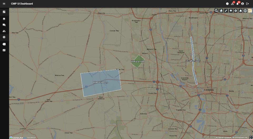
“Hilliard is excited to leverage this and other airspace services that Ohio has established to enable our first responder drone operations” says Deputy Police Chief for Hilliard, Ron Clark. “These services will be critical for us to achieve FAA approval and operate our drones in a safe and effective manner.”
In the coming years, more advanced and BVLOS drone operations will increase in Ohio, which means multiple operators may be flying in the same area to deliver medical supplies, perform emergency services, conduct infrastructure inspections, and even deliver commercial packages. For safe and successful scaling of commercial drone operations, it’s imperative that pilots have situational awareness for strategic deconfliction.
While both private and public organizations can enroll in the traffic management system, this resource is particularly valuable for other state agencies and local governments across Ohio. These services are available at no cost to any operator or fleet manager that requests access and goes through the onboarding process.